Tackling Coastal Erosion with Geospatial Solutions
GEO-LDN team uses earth observation to protect Ghana’s vulnerable coastline working towards land degradation neutrality
Key Takeway of This Article
Hover over to have a look!Value add for readers
- Learn how Ghana is using geospatial tools to track and combat coastal erosion.
- Insights from COP16 on leveraging earth observation for land degradation neutrality.
Why should this matter to development practitioners working in agriculture and rural development?
Coastal erosion isn’t just another environmental issue—it directly affects livelihoods, agricultural productivity and food security in coastal regions. As land is lost to the sea, fertile areas shrink, displacing communities and disrupting local economies that depend on coastal resources. Development cooperation efforts in agriculture and rural development cannot ignore the growing impact of land degradation in these vulnerable areas. Ghana’s innovative approach, leveraging geospatial data and Earth observation, offers valuable lessons for integrating technology into resilience strategies. For practitioners navigating similar challenges in their own regions, the insights from Ghana’s experience provide practical examples of how data-driven solutions can inform sustainable land use planning, disaster risk reduction, and policy decisions.
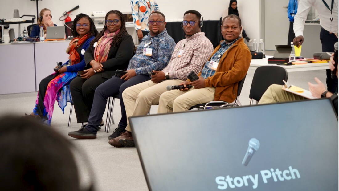
Team Ghana Coastal Erosion at the GEO-LDN Storytelling Workshop during COP16 in Ryadh, Saudi Arabia. In the picture: Julia Quaicoe (Lecturer at University of Cape Coast), Sandra Kesse-Amankwa (Chief Analyst at National Development Planning Commission), Ebenezer Ntsiful (Head of GIS at Land Use and Spatial Planning Authority), Eugene Nyansafo (Head of Urban and Spatial Planning Unit at PSS Urbania Consult Limited at PSS Urbania Consult Limited), Patrick Nii Lamptey (Research Scientist at Ghana Space Science and Technology Institute) ⎮ GEO-LDN Secretariat / [Mark Grasy]
Ghana’s 550km coastline is increasingly threatened by coastal erosion and flooding, with over 367 km—approximately two-thirds—already affected. Rising sea levels, tidal waves, and human activities have displaced communities, destroyed infrastructure, and degraded vital ecosystems. The impacts are especially severe in the Keta Lagoon area, where livelihoods depend on fragile coastal resources.
To combat these challenges, Team Ghana is using Earth observation data and geospatial tools to track shoreline changes, assess risks, and implement sustainable adaptation strategies. Their work is part of the GEO Land Degradation Neutrality (GEO-LDN) Flagship Initiative, which helps countries leverage geospatial technology to achieve land degradation neutrality and meet Sustainable Development Goal 15.3.
Ghana’s Geospatial Innovation for Coastal Resilience
In 2024, Team Ghana developed a national roadmap for land degradation neutrality, aligning with key planning frameworks, including the National Development Planning System Act (1994) and the Land Use and Spatial Planning Act (2017). The goal was to establish an Integrated Shoreline Position Monitoring System for the Lower Volta Basin in Keta, using state-of-the-art geospatial methods to monitor erosion trends and drive informed decision-making.
Key Components of Ghana’s Coastal Monitoring Approach
- Earth Observation & Remote Sensing
- Satellite imagery and drones track shoreline movements and detect land degradation patterns.
- Bathymetric surveys assess underwater changes, crucial for understanding erosion dynamics.
- Data-Driven Early Warning Systems
- The team uses high-resolution geospatial data to map vulnerable areas and provide early warnings for at-risk communities.
- Stakeholder Mapping & Collaboration
- Local government agencies, research institutions, and coastal communities are actively engaged in co-designing adaptation measures.
- Partnerships with GEO-LDN and international experts ensure access to the latest data, tools, and methodologies.
Through these efforts, Team Ghana is improving coastal resilience, ensuring that restoration projects are both science-driven and inclusive.
Team Ghana at UNCCD CoP16 in Riyadh
In December 2024, Team Ghana participated in UNCCD COP16 in Riyadh, Saudi Arabia, where GEO-LDN showcased the power of geospatial data in fighting land degradation. The GEO-LDN Pavilion served as a hub for policymakers, scientists, and practitioners to discuss best practices, tools, and real-world applications of Earth observation for land degradation neutrality.
Ghana’s Contribution at CoP16
- Sharing lessons from Coastal Monitoring: Ghana’s representatives presented how geospatial data is driving action on coastal erosion and protecting vulnerable communities.
- Technical Training & Capacity Building: Ghana participated in workshops on Google Earth Engine (GEE), Digital Earth Africa, and Kobo Toolbox, enhancing technical expertise for innovative methods of land monitoring.
- Cross-Sectoral Collaboration: Discussions with country teams from Kenya, Nigeria, Senegal, Colombia, and beyond fostered new partnerships and knowledge exchange.
- Storytelling for Impact: Team Ghana joined a storytelling workshop, learning how to effectively communicate the urgency of coastal erosion and mobilize stakeholders.
The GEO-LDN initiative at CoP16 reinforced the importance of data accessibility, capacity-building, and cross-sector collaboration in achieving land degradation neutrality.
A Model for Coastal Resilience
Ghana’s work on coastal erosion sets a global example of how geospatial technology and stakeholder engagement can drive climate adaptation and land restoration. By integrating Earth observation, participatory decision-making, and international collaboration, Team Ghana is paving the way for a more resilient and sustainable coastline. As the impacts of climate change and land degradation intensify, Ghana’s approach serves as a model for other nations striving to protect their coastal zones and achieve land degradation neutrality.
Contact
Julia Bayer-Cremer, Stakeholder Engagement & Communications, julia.bayer@giz.de
